Subject: Eastern United States Cities
Period: 1860 (dated)
Publication: New General Atlas
Color: Hand Color
This great set of city plans show the development of these six important cities in 1860. All are surrounded by Mitchell's first edition floral borders. Maps include:
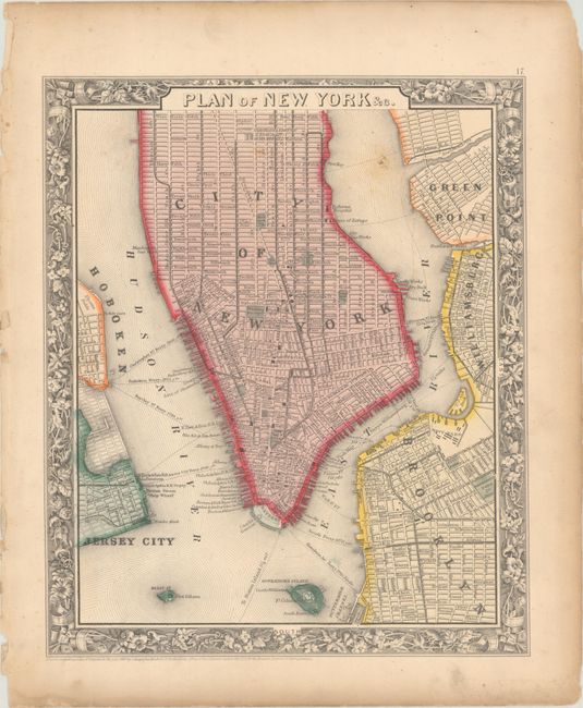
A. Plan of New York &c. (10.6 x 12.7"). The plan covers Manhattan south of 45th Street and extends to show parts of Green Point, Williamsburg, Brooklyn, Hoboken, and Jersey City.
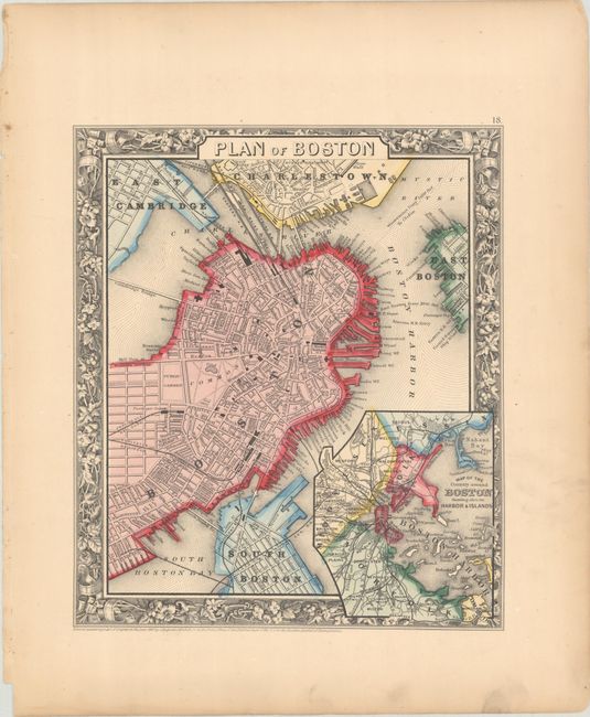
B. Plan of Boston (9.4 x 10.9"). A detailed plan of the city center with a number of individual buildings located and named including Paul Revere's house, Custom House, Exchange, American House, and more. Features an inset of the broader region entitled "Map of the Country Around Boston Showing Also it Harbor and Islands" extending from Nahant Bay to Plymouth and inland to Cambridge.
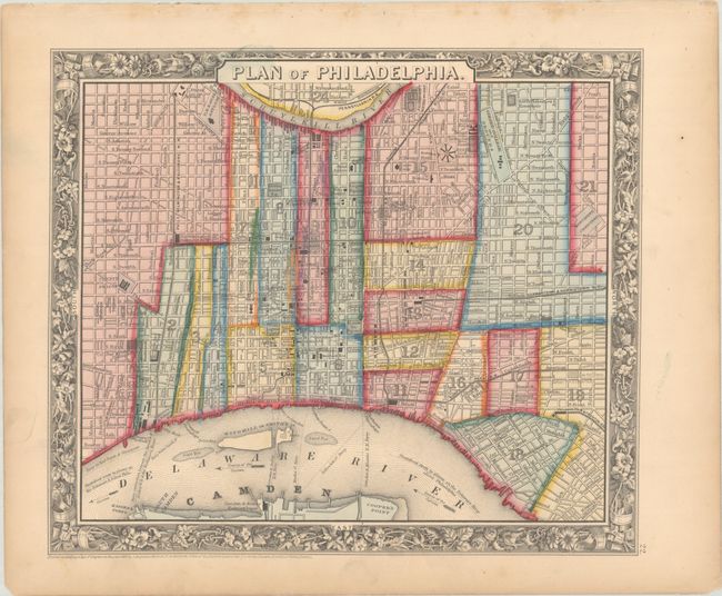
C. Plan of Philadelphia (12.7 x 10.9"). Extends to Cooper's Point in the south and is bordered by Schuylkill River on the north. The plan shows many points of interest and landmarks including railroad depots, squares, the U.S. Mint, the Girard Bank, Arch St. Theater, U.S. Naval Asylum, and the Fairmont Water Works.
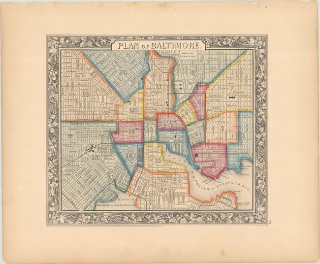
D. Plan of Baltimore (10.8 x 9.3"). Handsome city plan extending from Green Mt. Cemetery on Oliver south to the Patapsco River and Randal. Filled with historical landmarks and places of interest.
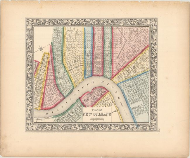
E. Plan of New Orleans (10.8 x 9.3"). The heart of the city is depicted in this plan: Bourbon and Canal streets, the Mississippi River, and the Mexican Gulf Railroad are clearly shown.
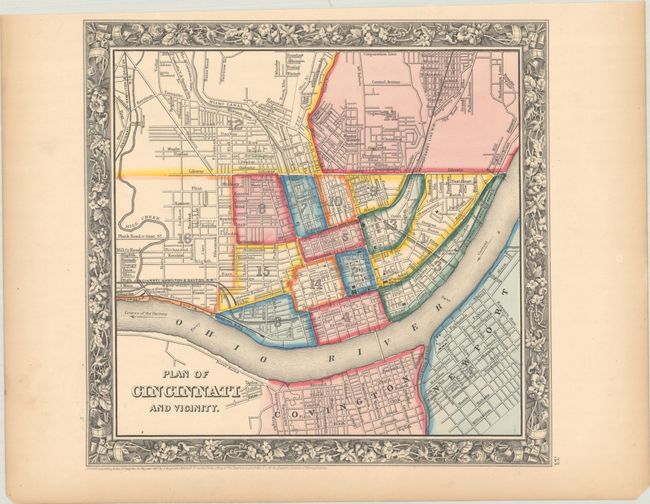
F. Plan of Cincinnati and Vicinity (11.2 x 10.8"). The plan depicts the individual wards, streets, railroads, and public buildings. It stretches from the Corporation Line north of Central Avenue and south across the Ohio River to Covington and Newport. Interesting landmarks such as the Public Landing and the Apollo Building are presented.
References:
Condition:
All are crisp impressions with contemporary color on slightly toned sheet. They are in A condition with light soiling mostly confined to the margins, with the exception of the New York City plan, which is in B+ condition with light soiling in the map image.