Subject: North America
Period: 1821 (dated)
Publication:
Color: Hand Color
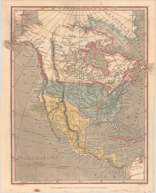
A. North America (8.3 x 9.6"). A small map showing United States' claims extending to the Pacific Ocean. While the engraved boundary with Canada reflects today's borders, the colorist has left the disputed region uncolored. California and the Southwest is under Spanish control where the L Tranpanogos is noted as "Doubtful" and a small lake beneath it whose "Western Limits...are unknown." The map is filled with rivers, mountains, Indian tribes, and limited settlements. It extends to Greenland, the far eastern tip of Asia, and northwestern South America. Engraved by Cooper. The imprint of Sherwood, Neely & Jones is below the bottom border.
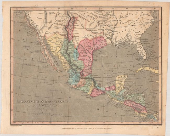
B. Spanish Dominions, in N. America (9.4 x 7.4"). A small map showing Spanish possessions extending from the San Francisco Bay to Panama. Topography is shown via hachure. Filled with place names including towns, forts, and Indian regions. The United States is shown east of the Mississippi River with a large Louisiana to its west. Engraved by Samuel Neele.
References:
Condition: B+
Issued folding with scattered foxing.