Subject: Asia
Period: 1708 (dated)
Publication:
Color: Hand Color
Size:
23 x 17.8 inches
58.4 x 45.2 cm
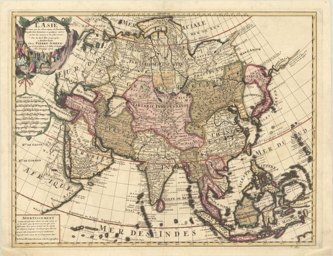
This scarce map of Asia is a close copy of Delisle's 1700 map of the continent. The coastline of northeastern Siberia is completed between the peninsula of Novaya Zemlya and Japan including Witsen's mountainous peninsula that juts into the sea, with a notation stating that it is unknown how far the peninsula extends. Hokkaido (Terre d'Yeco) is still attached to Japan, but there is now a narrow strait separating it from the mainland. Only the southern shoreline of Terre de la Compagnie is shown with a reference to the alleged discoveries of Joao de Gama. The map is boldly engraved and decorated with a title cartouche featuring a procession representing the silk road commerce.
References: Yeo #106.
Condition: B+
Very dark impression with full contemporary color in the map and later color in the cartouches. There is a bit of minor foxing and a couple of short cracks that have been professionally repaired on verso. Professional paper restoration in the lower corners, not affecting the map.