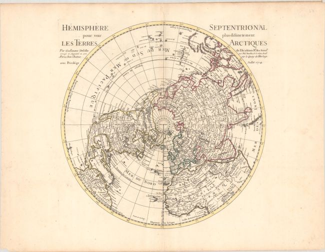
Subject: North Pole
Period: 1770 (dated)
Publication: Atlas Geographique et Universel
Color: Hand Color
Size:
17.9 x 18.1 inches
45.5 x 46 cm
This is an updated edition of Delisle's important map of the Northern Hemisphere. When first published in 1714, Delisle's map was the first map to correctly place the west coast of North America by moving it east substantially from previous mapping. This edition continues the coastline of the Pacific Northwest with a large island labeled Foufang that is attributed to the Chinese and serves as the western boundary of a large Mer de l'Ouest. Other conjectural rivers and lakes appear to the north, including Lake Valasco, and a rudimentary Alaska is named Presqu'Isle du Nord-Ouest. Buache has improved upon the depiction of Japan, although Hokkaido (Isle du Jeso) is still malformed. Only a small remnant of the Terre de la Compagnie appears near Hokkaido.
References: McGuirk #142; Phillips (Atlases) 3525, No. 4.
Condition: B+
A crisp impression on a large sheet with the watermark of a Maltese cross encircled in rosary beads. There is an extraneous crease along the centerfold, minor toning along the centerfold, and faint foxing.