Catalog Archive
Auction 192, Lot 514

"[On 2 Sheets] Nouvelle Carte des Etats du Grand Duc de Moscovie en Europe Partie Septentrionale [and] Partie Meridionale", Chatelain, Henry Abraham

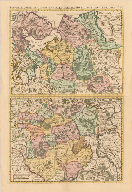
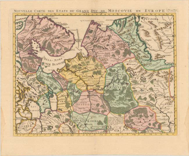
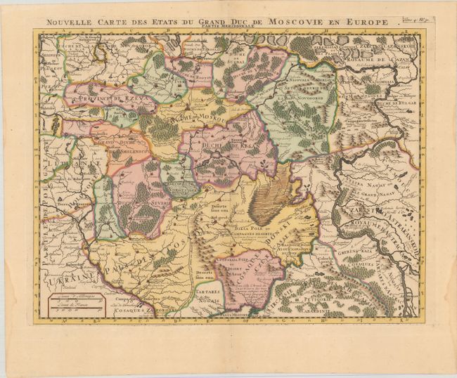
Subject: Russia in Europe

Period: 1720 (circa)

Publication: Atlas Historique

Color: Hand Color

Size:
18.3 x 13.7 inches
46.5 x 34.8 cm
Download High Resolution Image
(or just click on image to launch the Zoom viewer)

This set of strongly engraved and nicely detailed copperplate maps covers Russia in Europe. The northern sheet focuses on the region from St. Petersburg in the southwest, north to the Kola Peninsula, east to about Syktyvkar, and south to below Vologda. The southern sheet zeroes in on the heart of European Russia with Moscow near the center. On both maps, the topography, marshes and forests are graphically depicted. The titles are located above the map, just outside of the neatline.

References:

Condition: A

Crisp impressions on paper with "C & I H" watermarks. There is light dampstaining in the blank margins at bottom left and right. The first image is a composite image - this map is on 2 separate sheets.

Estimate: $230 - $275

Unsold

Closed on 4/26/2023

Archived