Subject: Berlin, Germany
Period: 1963 (circa)
Publication:
Color: Printed Color
Size:
33 x 23.8 inches
83.8 x 60.5 cm
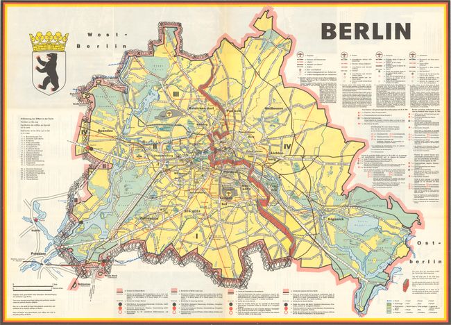
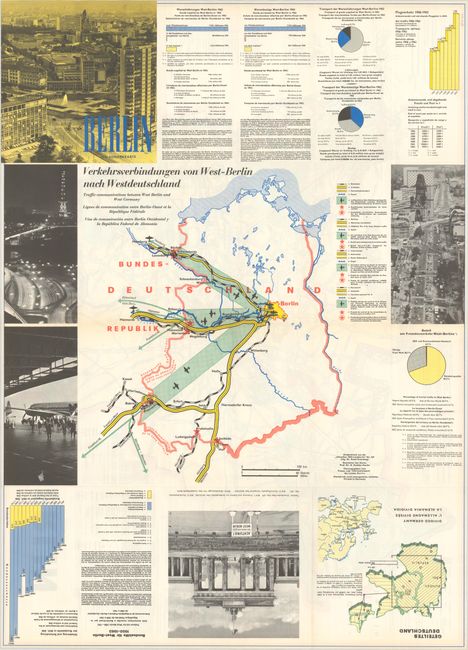
This fascinating tourist map centers on a graphic depiction of the Berlin Wall and the barbed wire fence surrounding much of West Berlin following World War II. Major roads, railways and subways are marked, and instructions are given in German, English, French and Spanish on how and where to cross between East and West Berlin due to the interruption in service lines along the Berlin Wall. A few important buildings are shown in blue and identified in a numbered key at left. On verso is a map showing the lines of communication between West Berlin and the rest of Germany, as well as statistical information and charts on imports and exports to West Berlin, air traffic, the share of tourism to West Berlin, and Federal aid statistics for West Berlin. The map was created by Gustav Fochler-Hauke and published by the Berlin Press and Information Office.
References: PJ Mode Collection #1374.01; Rumsey #10694.
Condition: A+
Clean and colorful, issued folding.