Catalog Archive
Auction 192, Lot 476

"Partie Septle. de Cercle de la Haute Saxe Divisee par ses Principautes", Robert de Vaugondy

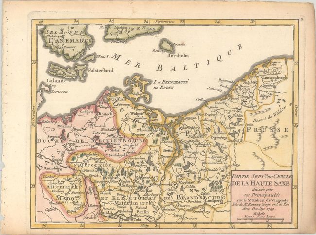
Subject: Northeastern Germany & Northwestern Poland

Period: 1749 (dated)

Publication: Atlas Portatif Universel et Militaire

Color: Hand Color

Size:
8.3 x 6.5 inches
21.1 x 16.5 cm
Download High Resolution Image
(or just click on image to launch the Zoom viewer)

This small map depicts the historical region of Upper Saxony. This map stretches from Wismar on the coast of the Baltic to the historical Pomerelia region in northern Poland, down south to Berlin. The map is filled with details of political divisions, towns and cities, rivers, forests, and mountains.

References: Pedley #263.

Condition: A

A crisp impression on a bright, watermarked sheet with light toning along the edges.

Estimate: $95 - $120

Sold for: $70

Closed on 4/26/2023

Archived