Subject: Western South America & Central America
Period: 1777 (circa)
Publication: Histoire Generale des Voyages
Color: Black & White
Size:
20.8 x 13 inches
52.8 x 33 cm
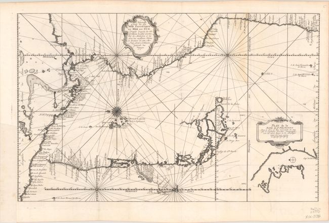
A very unusual map that despite the title depicts the Pacific coastline from Acapulco to Tierra del Fuego and the Galapagos Islands. The southern part is disembodied and placed into the middle of the map in a partial inset and a smaller inset shows the Bay of St. Francois near Cape Horn along the southern coast of Tierra del Fuego. The coastline is filled with place names. South of Chiloe Island is an additional inset depicting the coastline between Ro. Sinfondo and Cap Corso in more detail. Along this tiny inset are two notes indicating the location where Captain Cheap shipwrecked the HMS Wager in 1741, which had been part of Commodore George Anson's squadron, as well as the location of an estuary or canal known as both Purgatoire (Purgatory) and Diego Gallegos where another shipwreck occurred. The map is decorated with two cartouches and a compass rose orienting north to the left.
References:
Condition: B+
A dark impression on a bright sheet with a fleur-de-lis watermark, issued folding with light offsetting and a light stain along the Tropic of Capricorn.