Subject: Brazil
Period: 1638 (published)
Publication: Atlas Novus
Color: Hand Color
Size:
19.3 x 14.9 inches
49 x 37.8 cm
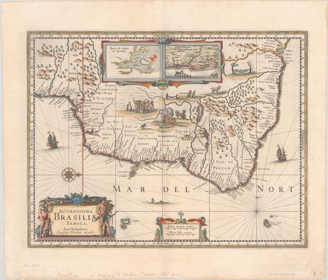
Magnificent depiction of Brazil with north oriented to the right by a handsome compass rose. The map is inset with two regions of Dutch interest in the area: Baja de Todos los Sanctos and Pernambuco. The interior is bereft of geographical information except for largely imaginary rivers and forests. Instead the region is filled with dramatic scenes of the indigenous people, including warfare and cannibalism, and some curious wildlife. The hereditary captaincies established by the Portuguese are noted along the coastline. The decorative title cartouche is flanked by a native family and the seas are adorned with sailing ships, a sea monster, and a compass rose. Latin text on verso.
References: Van der Krogt (Vol. I) #9850:1.1.
Condition: A
A crisp impression with faint dampstaining in the bottom blank margin and a pair of tiny wormholes in the top blank margin.