Catalog Archive
Auction 192, Lot 346

"A New Map of the Caribbee Islands in America", Anon.

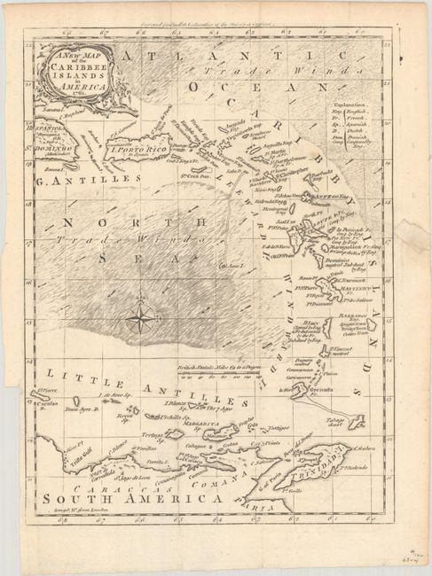
Subject: Lesser Antilles

Period: 1761 (dated)

Publication: Smollet's Continuation of the History of England

Color: Black & White

Size:
7.3 x 9.7 inches
18.5 x 24.6 cm
Download High Resolution Image
(or just click on image to launch the Zoom viewer)

This attractive chart presents the West Indies from the eastern portion of Hispaniola to include the Little Antilles, Trinidad and a portion of northern South America. Legend identifies colonial ownership and lands conquered by England. The seas are fully engraved with arrows indicating the prevailing winds. A handsome small map of the Caribbean published near the end of the French and Indian War.

References: Sellers & Van Ee #1725.

Condition: B+

Issued folding on watermarked paper with a 1.75" edge tear at right and a tiny binding tear at left both closed on verso with archival materials.

Estimate: $140 - $170

Sold for: $80

Closed on 4/26/2023

Archived