Subject: Oregon
Period: 1872 (dated)
Publication:
Color: Hand Color
Size:
22.3 x 15.8 inches
56.6 x 40.1 cm
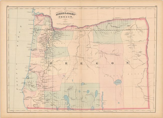
An attractive map of the state showing development confined to the coastal west with large, mostly unsurveyed counties to the east. County development is current to the date of the map with Grant and Union counties having been established in 1864. The map locates numerous towns and villages, forts, rivers, lakes and railroads. The Oregon California Railroad extends from Oakland north to E. Portland, and the Oregon Central Railroad runs between Portland and the vicinity of Lincoln.
References:
Condition: B+
Contemporary color with a hint of toning and offsetting, and a short tear along the lower centerfold that has been closed on verso with archival tape.