Catalog Archive
Auction 192, Lot 247

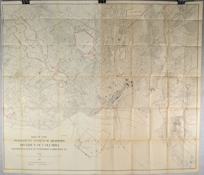
Early Highway Map of Washington, D.C. Showing Proposed Subdivision Plans

"Map of the Permanent System of Highways District of Columbia Prepared in the Office of the Engineer Commissioner D.C.", U.S. Government

Subject: Washington, D.C.

Period: 1908 (dated)

Publication: Sen. Doc. 653, 60th Congress, 2nd Session

Color: Printed Color

Size:
53 x 44.3 inches
134.6 x 112.5 cm
Download High Resolution Image
(or just click on image to launch the Zoom viewer)

This mammoth map was issued on two sheets and joined together. It presents the street-grid pattern of the city in fine detail with many important buildings identified including the Washington Monument, Smithsonian, Executive Mansion, Capitol, Naval Observatory, and many more. The map extends across the Potomac River to include Rosslyn, Arlington and the National Cemetery, and also names several new subdivisions including Chevy Chase, Woodley Park and Cleveland Park. A legend at bottom left further identifies existing and proposed highways. Lithographed by Julius Bien in New York.

References:

Condition: B+

Issued folding with light toning on the right half of the map and numerous short splits at the fold junctions.

Estimate: $140 - $170

Sold for: $60

Closed on 4/26/2023

Archived