Subject: San Francisco & Sacramento, California
Period: 1854 (circa)
Publication: Atlas von Nord-America
Color: Hand Color
Size:
10.6 x 8.3 inches
26.9 x 21.1 cm
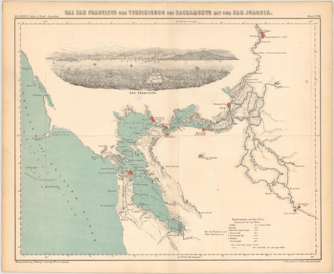
This is a scarce map of the greater San Francisco Bay area and central California to include the lower Sacramento Valley and the upper San Joaquin Valley. The map has good detail of San Francisco Bay (including soundings) and of the waterways that make up the Sacramento and San Joaquin Rivers. There are some seldom seen settlement names such as New York, San Joaquin, Stanislaus City and Boston, located just north of and across the river from Sacramento. The lower right has a legend with distances between settlements on these river systems. The most prominent feature of the map is a large (2 x 6") view of San Francisco Bay complete with sailing ships with the city rising in the background. Vallejo is noted as the capital which dates the map to either 1852 or 1853 when it was the capital for two brief periods. Blank verso.
References:
Condition: B+
Light toning along the centerfold and sheet edges.