Subject: Northwestern United States
Period: 1879 (dated)
Publication:
Color: Hand Color
Size:
18.3 x 16 inches
46.5 x 40.6 cm
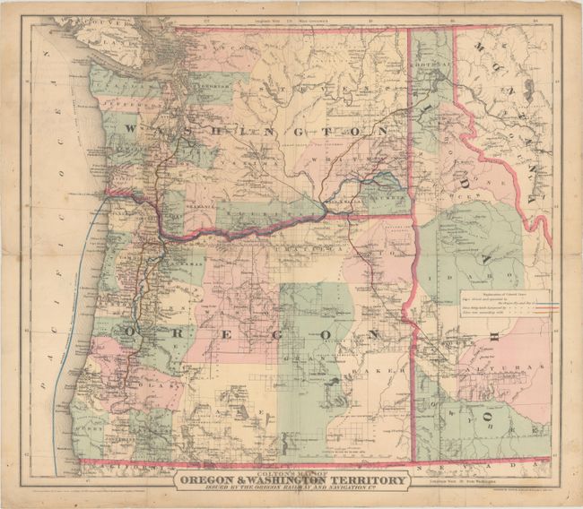
This detailed map of the Northwest extends from the Pacific Ocean to Idaho and western Montana. It was prepared by the Colton firm and issued by the Oregon Railway and Navigation Company. The map features a legend identifying the company's existing routes (blue) which extend to include Eugene City, Walla Walla, Lewiston and San Francisco, with proposed lines (pink) and connecting lines (yellow) also depicted. Development is mostly confined to west of the Cascades, with limited surveying having been completed in the central and eastern portions of Oregon and Washington. The map locates forts, camps, Indian Reservations, topography, watersheds, and much more.
The Oregon Railway and Navigation Company was incorporated in 1879 (the date of this map) and operated mostly in eastern Oregon and Washington until 1896 when it was subtly renamed The Oregon Railroad and Navigation Company with several smaller lines added to the company's portfolio. The Union Pacific Railroad bought a majority share in 1898, and the lines became the backbone of the Union Pacific Railroad mainline from Utah to the Pacific Northwest. We found only one past sale for this map in the last 40 years.
References:
Condition: B
Issued folding with archival repairs to a 5" edge tear at left and several small fold separations. There is minor staining and soiling.