Subject: Wyoming & Idaho
Period: 1873 (published)
Publication: Sixth Annual Report of the United States Geological Survey...
Color: Black & White
Size:
10 x 10.6 inches
25.4 x 26.9 cm
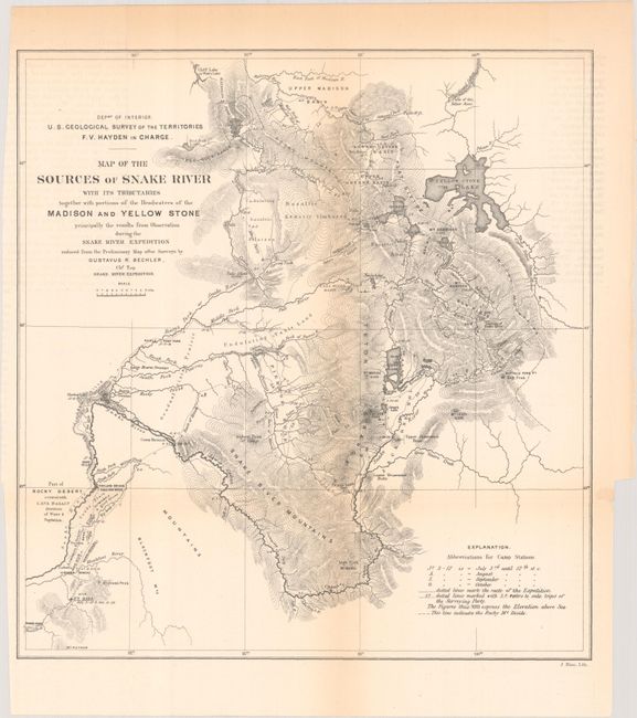
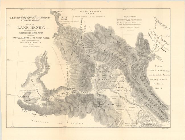
These two maps were issued in F.V. Hayden's Sixth Annual Report of the United States Geological Survey of the Territories, Embracing Portions of Montana, Idaho, Wyoming, and Utah:
Map of the Sources of Snake River with Its Tributaries Together with Portions of the Headwaters of the Madison and Yellow Stone... (9.9 x 10.3"). Shows northern Wyoming and the Yellowstone area drawn during Hayden's Geological Survey of 1871. This area later became Yellowstone National Park in 1872 and Hayden's surveying efforts were a significant factor in Congress' decision to create the park. The map shows Yellow Stone Lake, Jackson's Lake, the Snake River and relief through hachure. Condition: Issued folding with light toning along the folds and sheet edges. (B+)
Sketch of Lake Henry, the Sources of West Fork of Snake River including Tahgee, Madison and Red Rock Passes (11.8 x 8.4"). This map of Henrys Lake, Idaho, gives good detail of the topography and drainage in the region. Descriptions of this region include marshy prairie, grassy bottom, dense pine timber, and high rocky bluffs among others. Condition: Issued folding with numerous fold separations that have been closed on verso with archival tape. (B)
References: Blevins (Mapping Wyoming) #238.
Condition:
See description above.