Catalog Archive
Auction 192, Lot 205

NO RESERVE

"J.H. Colton's Map of Nevada Utah and Arizona", Colton, Joseph Hutchins

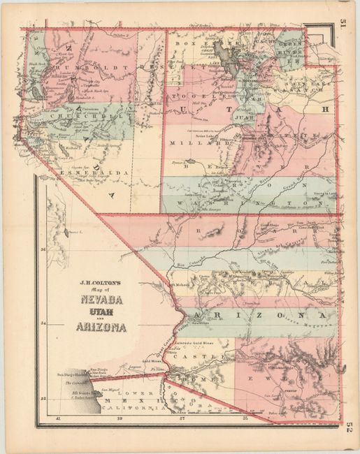
Subject: Western United States

Period: 1864 (circa)

Publication:

Color: Hand Color

Size:
9 x 10.8 inches
22.9 x 27.4 cm
Download High Resolution Image
(or just click on image to launch the Zoom viewer)

This small map was issued in Colton's Condensed Octavo Atlas of the Union. It presents Arizona Territory with seven counties and encompasses the southern tip of Nevada. The border between Utah and Nevada is at 115 degrees with the eastern portion of Nevada unorganized. The Pony Express route is shown, as is the Mail Route. The map is filled with place names, information on topography and watershed, explorer routes, and notations.

References:

Condition: A

A few minor spots, otherwise fine.

Estimate: $60 - $80

Sold for: $95

Closed on 4/26/2023

Archived