Subject: Central United States
Period: 1836 (published)
Publication:
Color: Hand Color
Size:
18 x 18.7 inches
45.7 x 47.5 cm
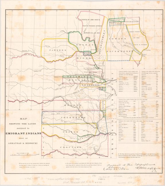
This attractive map covers the region of present-day Iowa, Nebraska, Kansas and Oklahoma with tribal lands outlined in contemporary hand color. An inset provides tabulations of the numbers of Indians and a listing of estimated acres of land assigned to these Tribes. While it shows the Santa Fe Road, the route of Col. Dodge is not depicted. The map is based on the 1835 map prepared by Lt. Washington Hood, with Wheat calling it "an important historical map." It documents an ugly phase of American history during the first half of the 19th century when Indian tribes were forced to migrate to the areas shown. This is the original and rare issue of 1836, not to be confused with the later issue in the American State Papers.
References: Claussen & Friis #127; Wheat (TMW) #418; Wagner-Camp #63.
Condition: B
Issued folding with scattered foxing. There is an old stamp for the Concord Free Public Library on verso.