Subject: Southeastern United States
Period: 1832 (published)
Publication: American Journal of Science and Arts, Vol. XXIII
Color: Black & White
Size:
14.4 x 11.7 inches
36.6 x 29.7 cm
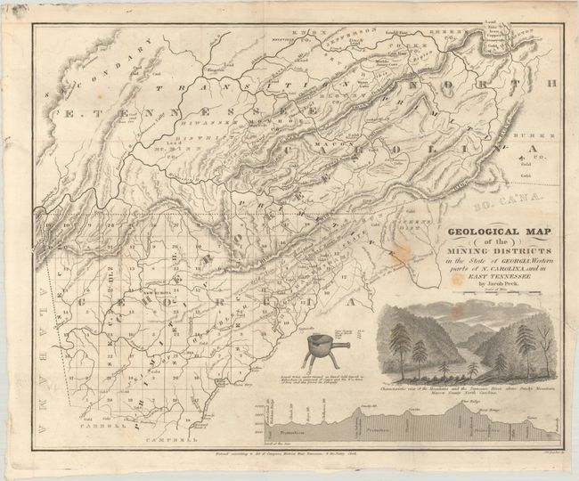
This uncommon map is the earliest geological map of the Southern states in Marcou & Marcou and is filled with notations locating gold and gem deposits. The map was made during a small gold rush in this region and the profusion of "gold" locations noted across the map would lead a person to believe the area was saturated with the precious metal. The map is centered on the Valley River and stretches north to above the Tennessee River as far as Kingston west to Alabama, and east to Burke County. Across the bottom is a cross-section with principle mountain peaks located. An engraved inset of the Smoky Mountains is captioned "Characteristic view of the Mountains and the Tennessee River above Smoky Mountain; Macon County North Carolina." A vignette shows a small pot found 15 feet underground whose composition of copper and tin with a trace of iron "proves its antiquity." This rarely seen map was published in New Haven by Jacob Peck.
References: Marcou & Marcou #541.
Condition: B+
Issued folding with a few small stains and a 2" edge tear at right that has been closed on verso with archival tape.