Subject: Eastern Canada
Period: 1808 (dated)
Publication: Atlas to Cruttwell's Gazetteer
Color: Hand Color
Size:
15.4 x 13.3 inches
39.1 x 33.8 cm
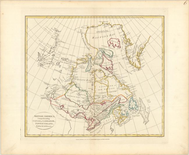
This scarce map of Canada extends from Greenland across the continent to Great Slave Lake (here called Arathapescow Lake), north of today's Alberta. It delineates the lands of the Copper, Dog Ribb'd, and Northern Indians. The map shows a small portion of coastline far to the north on the Beaufort Sea at the delta of the Copper River. There is good detail of the river and lake systems from Great Slave Lake to the Great Lakes and the St. Lawrence River. The Mississippi River's source lies just south of Lake Winnipeg. The map is filled with fascinating notations (an area east of Lake Winnipeg is noted "The Climate of this Land is a great deal more temperate than Hudson's Bay"), and several notes concern recent discoveries. The Great Bank and numerous smaller fishing banks are located. The map extends to name Pennsylvania, New York, and New England. Engraved by Neele and published by Longman & Co.
References:
Condition: A
A crisp impression with contemporary outline color on a bright sheet with an "IIS 1805" watermark and minor toning along the centerfold.