Subject: Eastern Canada
Period: 1790 (circa)
Publication:
Color: Black & White
Size:
13.5 x 9.1 inches
34.3 x 23.1 cm
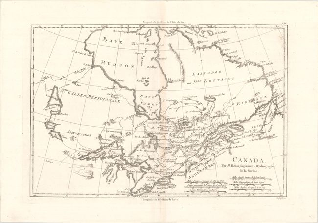
This precisely engraved map covers the region from Newfoundland through the St. Lawrence River basin and westward to Lake Winnipeg, including most of Hudson Bay. Many Indian tribes are named throughout, and several early forts are located. With six distance scales. Longitude measured from Paris along the lower scale and from I'Isle de Fer along the top. While typically engraved by Andre, this example was engraved by Scattaglia, who also worked for Bonne.
References: cf. Kershaw #383.
Condition: B+
A crisp impression on a bright sheet with a massive "Real" coat-of-arms watermark and light toning along the centerfold.