Subject: Atlases
Period: 1856 (published)
Publication:
Color: Hand Color
Size:
16.8 x 19.3 inches
42.7 x 49 cm
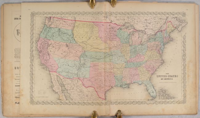
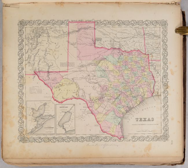
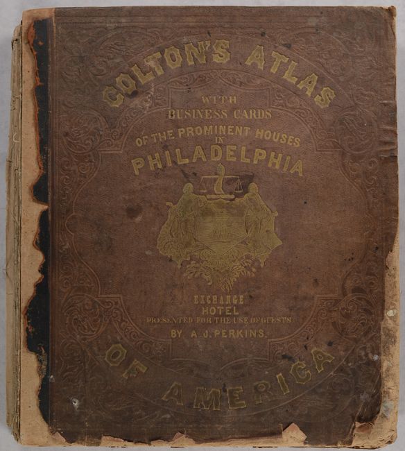
This attractive folio atlas was “limited to one thousand copies” and contains 53 single-page maps and 2 double-page maps. It is missing three maps from the table of contents (which lists 63 sheets) including the maps of Connecticut, Pennsylvania and St. Louis (which is on a sheet with Chicago). The table of contents also called for double-page maps of New York (state) and Texas, but single-page maps were included here. Some maps are also out of order to the table of contents. The atlas is similar to Volume I of Colton's Atlas of the World but is more robust (63 sheets versus 44). Included are double-page maps of the United States and New York City, and several maps of the western United States showing early and unusual territorial configurations.
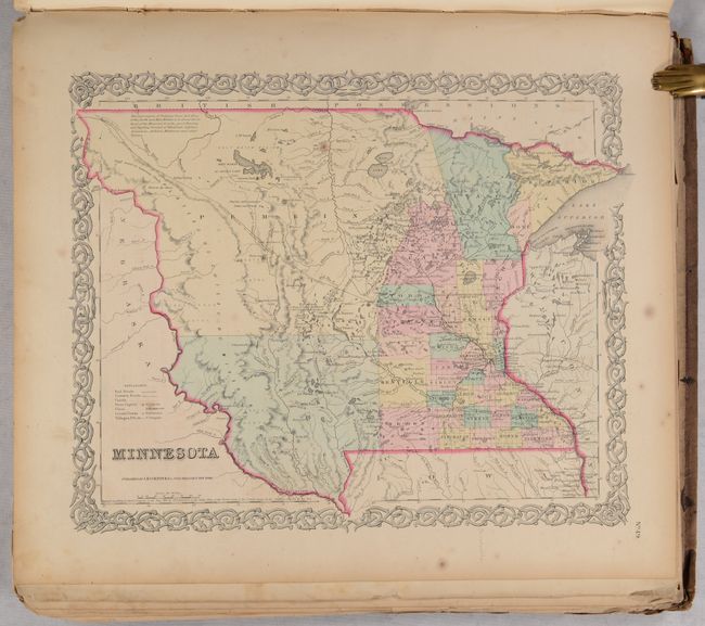
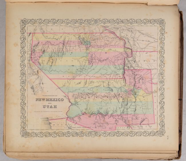
Of particular interest is the United States map, which features early western territorial boundaries. There is no sign of Dakota as Minnesota Territory extends to Nebraska at the Missouri River. The huge Nebraska Territory stretches between Minnesota to Oregon and Washington Territories at the Continental Divide, and south to Kansas. The large Kanzas Territory borders Utah and New Mexico in the west as there is no Colorado. Utah and New Mexico are both shown in their largest configurations. The border with Mexico is post-Gadsden Purchase. The map is filled with details and place names, forts, Indian tribes, emigrant roads, and much more of interest.
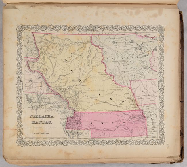
The atlas also includes the most desirable Nebraska and Kanzas map that depicts Nebraska stretching from Kansas to the Canadian border and bounded on the west by Washington and Oregon at the Continental Divide and Dakota on the east. Other maps include the territories of New Mexico and Utah, a California map with the large inset of San Francisco, and the territories of Washington and Oregon with their eastern boundaries on the Continental Divide. U.S. city plans include Boston, Philadelphia, Baltimore, Washington, Savannah/ Charleston, Louisville/New Orleans, and Pittsburgh/Cincinnati.
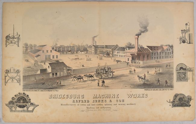
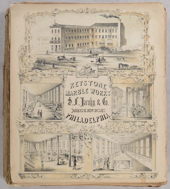
The maps are complimented by a frontispiece showing Native American Indians overlooking a valley filled with frontier settlement and development, and 7 (of 18) very attractive single and double-page illustrations advertising Philadelphia companies (listed in the “Index of Lithographs and Illustrated Views”). 4 additional lithographs not listed in the index include: Harrison & Newhall (coffee, sugar), Colbert’s Envelope Manufacturing, Henry B. Ashmead (Printer), and a second and different lithograph of Cornelius Baker (lamps). An additional 70 pages of advertisements are found throughout the text making this atlas a wonderful snapshot of the mid-19th century. Disbound, covers are present.
References:
Condition: C+
The maps are fair to mostly good with evidence of heavy use including light to moderate soiling and foxing that is most prominent in the lower right corners of the sheets. A few maps are heavily foxed and a couple others have pencil notations in the margins. The map of the United States has a short centerfold separation confined to the decorative border at bottom. One of the double-page advertising views is heavily creased with several chips along the sheet edges, and there are smaller chips and tears to some of the other advertisements. The text block has separated from the boards and many of the pages are loose. Covers are heavily worn with loss along the edges of the front cover. Given the scarcity of the atlas, this example would benefit greatly from professional conservation.