Subject: Atlases
Period: 1764 (published)
Publication:
Color: Hand Color
Size:
10 x 13.1 inches
25.4 x 33.3 cm
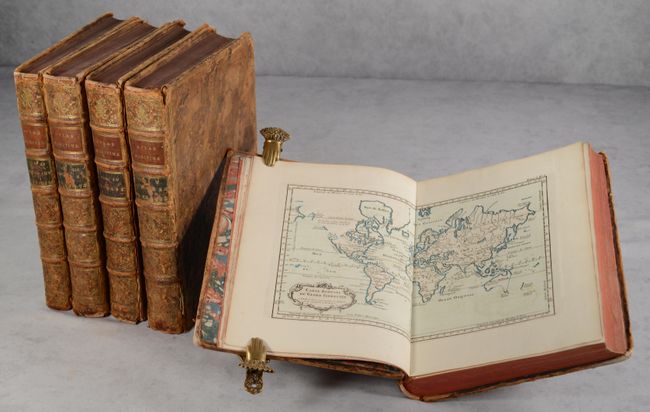
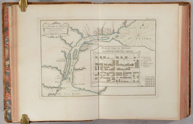
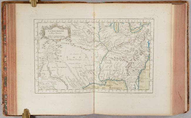
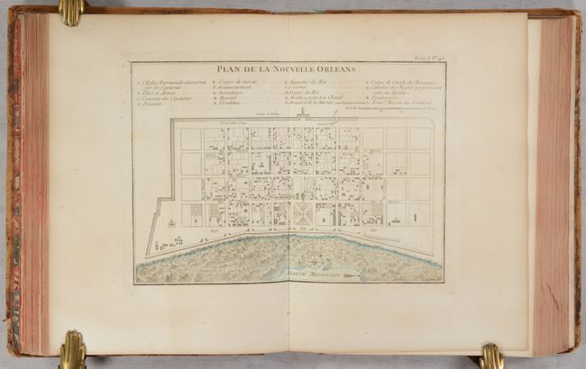
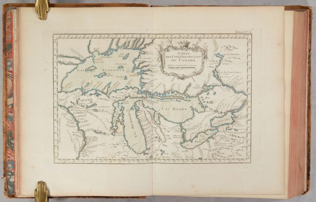
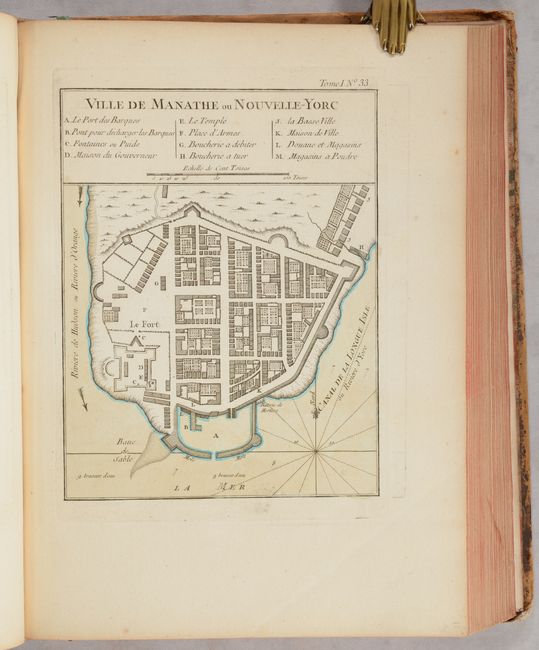
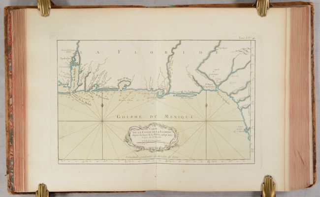
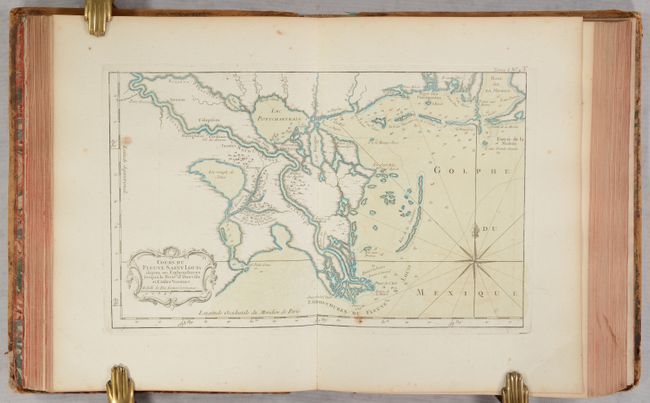
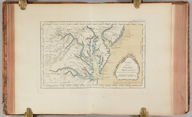
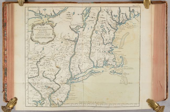
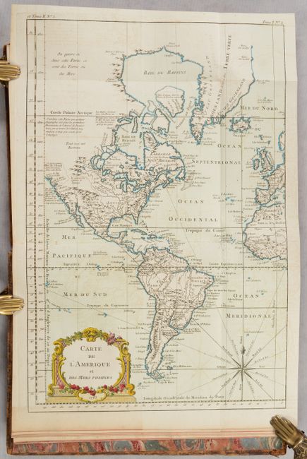
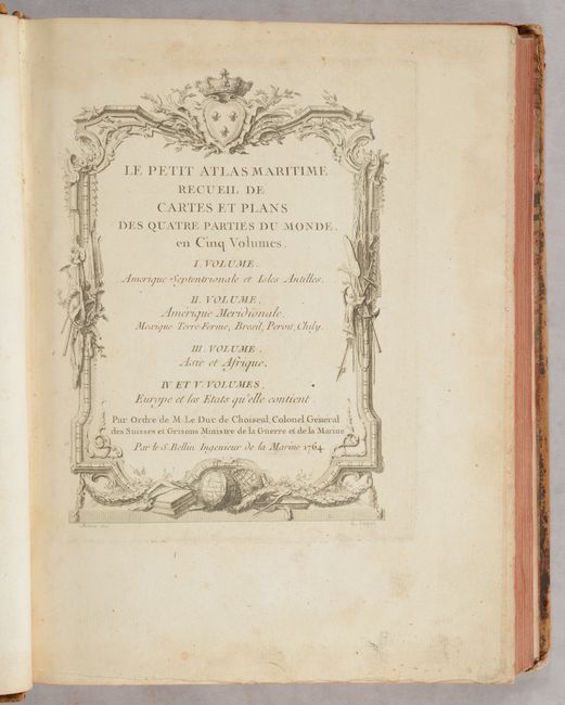
This is the complete five-volume set of Bellin's Le Petit Atlas Maritime containing 581 maps and plates. This is one of the most important maritime atlases of the mid-eighteenth century and includes both reduced-size maps from Bellin's other atlases, as well as new material. In his introduction, Bellin explains that he ensured the maps were both precise and pleasing to the eye. The work was ordered by Étienne François, Duc de Choiseul and first Minister of the State, and in order to make it affordable to the public, the majority of the expenses were paid by the Ministre de la Marine (Minster of the Navy). The prices quoted are 96 livres for editions in black and white, 120 livres for color, and 144 livres for colored examples bound in calfskin with gilt titling. Each volume focuses on a different region: Volume I on North America and the West Indies; Volume II on Central and South America; Volume III on Asia and Africa; Volume IV on Europe (except France); and Volume V on France. The atlas features maps of the world and continents, as well as numerous regional maps, city plans (such as Quebec, Boston, New York, Philadelphia, and New Orleans) and coastal charts each with decorative title cartouches and uniform page numbers in the top right corner. Maps of particular interest include:
A. La Riviere du Detroit
B. La Louisiane et Pays Voisins
C. Plan de la Nouvelle Orleans
D. Carte des Cinq Grands Lacs du Canada
E. Ville de Manathe ou Nouvelle-Yorc
F. Carte de la Coste de la Floride
G. Cours du Fleuve Saint Louis
Large Quarto. Full contemporary calf with covers bordered in gilt; spines with five raised bands, gilt decorations, and red and black leather title labels; marbled end-papers; all edges red.
References: Phillips (Atlases) #3508; Shirley (BL Atlases) M.BELL-5a.
Condition: B+
The maps are in full contemporary color with the majority in near fine (A) to very good (B+) condition with very light toning, occasional offsetting, and occasional light foxing. Some of the maps are in good (B) condition with more noticeable foxing or toning. The title pages have moderate toning and staining along the edges. There are old library stamps on the verso of each title page marked "Abgegeben" (deaccessioned). The covers are all heavily bumped and worn with abrasions on covers and cracking on the spines.