Catalog Archive
Auction 191, Lot 764

Bellin's Large Chart of the Pacific Ocean with Partial Coastlines

"Carte Reduite des Mers Comprises Entre l'Asie et l'Amerique Apelees par les Navigateurs Mer du Sud ou Mer Pacifique...", Bellin, Jacques Nicolas

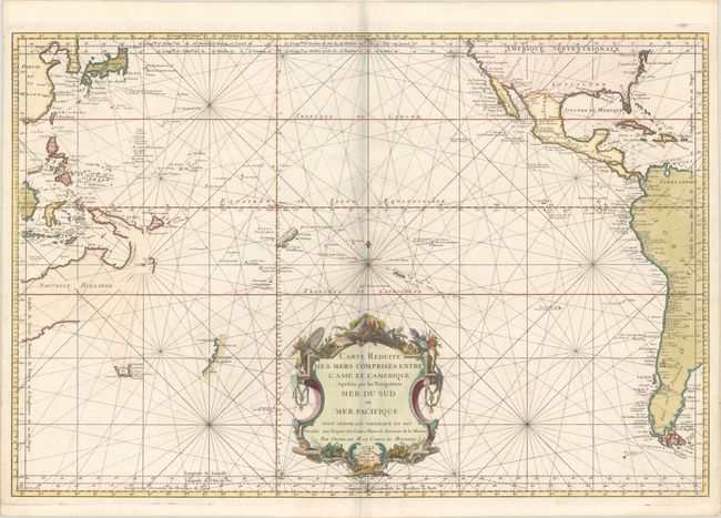
Subject: Pacific Ocean

Period: 1756 (dated)

Publication:

Color: Hand Color

Size:
33.4 x 22.3 inches
84.8 x 56.6 cm
Download High Resolution Image
(or just click on image to launch the Zoom viewer)

First published by Bellin in 1742, this chart has been updated and corrected to 1756. It focuses on the South Pacific, extending to China, Korea & Japan in the northwest and North America and western South America in the east. The chart presents a partial coastline for Australia with long speculative lines connecting it to both Tasmania and New Guinea. New Zealand is shown as a single island with only the western coast delineated, and Japan's shape and orientation is exaggerated. Rhumb lines and scores of tiny islands fill the waters, which would be carefully explored over the following decades. Decorated by a compass rose with fleur-de-lis and elaborate title cartouche. Engraved by Dheulland.

References: Tooley (Australia) p. 23, #153.

Condition: A

A dark impression on a clean bright sheet of watermarked paper.

Estimate: $1,100 - $1,400

Sold for: $800

Closed on 2/8/2023

Archived