Subject: Eastern Madagascar
Period: 1775 (circa)
Publication: Le Neptune Oriental
Color: Black & White
Size:
19.1 x 26.4 inches
48.5 x 67.1 cm
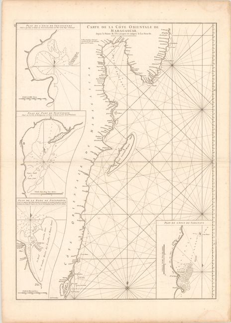
This charts shows the eastern portion of Madagascar's coast and several nearby islands. It extends from Lake Tampolo (Lac de Nosse Be to north of Antongil Bay and features four insets that provide close-up views of varying sections of coastline. Engraved by Guillaume Nicolas Delahaye.
A French sailor and hydrographer, D' Après de Mannevillette (1707-1780) used new instruments to correct the latitudes measured by previous explorers. His atlas Le Neptune Oriental, first published in 1745, was considered a major achievement and an indispensable resource for navigators.
References: Shirley (BL Atlases) M.APR-1c.
Condition: B+
A bright sheet with a small birdhouse watermark, light offsetting, and a few spots of soiling.