Subject: Southern Asia
Period: 1730 (circa)
Publication:
Color: Hand Color
Size:
20.3 x 16.3 inches
51.6 x 41.4 cm
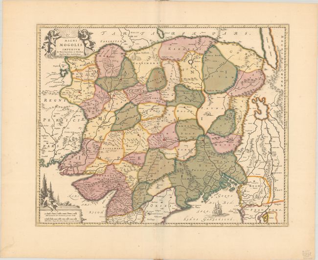
This is De Wit's scarce version of the Empire of the Great Moghul in northern India. The map extends to include the region from Iran to Burma. The Indus and Ganges rivers are the most prominent features of the map, along with the large imaginary lake located in northern Burma. This lake's origins are linked to Hindu-Buddhist mythology and appeared on maps, in some form, up until the early 20th century. Elephants are shown in the Ganges basin and camels are depicted in Kashmir. Adorned with putti and a sailing ship. This edition was published by Covens & Mortier, whose imprint has been added to the title cartouche.
References:
Condition: A
A crisp impression with full contemporary color on a bright sheet.