Catalog Archive
Auction 191, Lot 690

"Nieuwe Kaart van 't Keizerryk Japan, na de Nieuste Ontdekkingen...", Tirion, Isaac
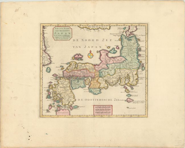
Subject: Japan

Period: 1740 (circa)

Publication: Nieuwe en Beknopte Hand-Atlas

Color: Hand Color

Size:
12.5 x 10.9 inches
31.8 x 27.7 cm
Download High Resolution Image
(or just click on image to launch the Zoom viewer)

This handsome map of Japan is based on the Kaempfer/Scheuchzer type. In this map Tirion makes a correction to his previous map of Japan by incorporating the more correct northern tip of Honshu and the southern tip of Hokkaido based on Kaempfer's manuscript, or perhaps taken from an inset on Scheuchzer's map. The route of the Dutch expedition between Nagasaki and Edo is shown.

References: Hubbard #87; Shirley (BL Atlases) T.TIR-2a; Walter #79 & OAG-91.

Condition: A

A crisp impression with full contemporary color on a bright sheet with the watermarks of a Strasbourg Lily and "I Villedary." There is light soiling in the blank margins.

Estimate: $475 - $600

Sold for: $250

Closed on 2/8/2023

Archived