Subject: Northern Asia
Period: 1640 (circa)
Publication: Theatrum Orbis Terrarum
Color: Black & White
Size:
19.6 x 15 inches
49.8 x 38.1 cm
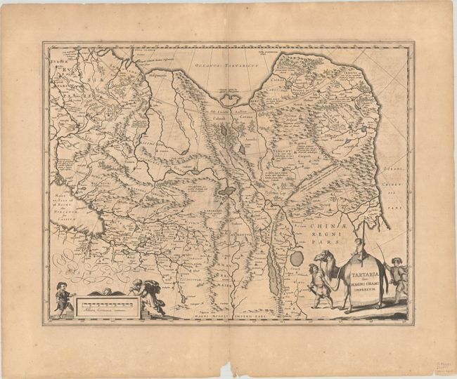
This great map of Tartaria covers all of eastern Asia between the Caspian Sea and northern China and Manchuria. Being one of the most remote regions of Asia, it was among the last to be properly explored and mapped. This map combines the knowledge obtained by the English and Dutch explorers as far as the Ob River with the balance of the map based on the reports of Marco Polo and the Greek classics. The deserts are filled with a wild assortment of devils and dragons, being held at bay from China by the Great Wall. Explorers flank the distance scale and the title is symbolically engraved onto the saddle blanket of a camel, representing the trade over the Silk Road. This map is nearly identical to Jansson's map of the same title, but includes meridians and degrees of longitude at top and bottom. Latin text on verso, published between 1640-55.
References: Van der Krogt (Vol. II) #8050:2.
Condition: B
A dark impression on a toned sheet with light offsetting. There is a chip at bottom center and a couple of tiny tears along the edges of the sheet.