Subject: Southeastern Europe
Period: 1710 (circa)
Publication:
Color: Hand Color
Size:
23.6 x 20.5 inches
59.9 x 52.1 cm
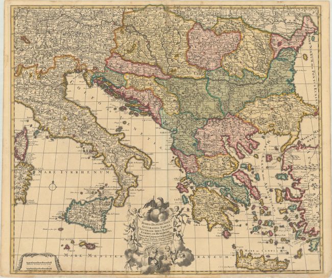
This rare map was published by Jacques (Jacob) de la Feuille, son of Daniel de la Feuille, and is one of the few maps that include his imprint. The map follows the course of the Danube River from its origination in Germany to where it drains in the Black Sea. The map extends from Sardinia, Corsica and Italy to Turkey and Crete and is filled with place names, political boundaries, and graphic depictions of forests and mountains. The road from Belgrade to Constantinople is also shown. Adorned with a lovely title cartouche that features putti, as well as an eagle and a lion wielding swords.
References:
Condition: B+
A sharp impression with full contemporary color and a bit of soiling along the centerfold at top and bottom. There are archival repairs to a number of small worm holes and tracks along the centerfold and the top and bottom edges of the sheet, with a minor amount of image replaced in facsimile.