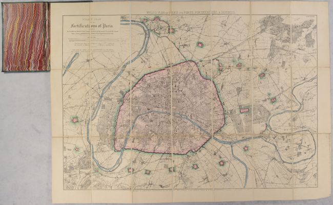
Subject: Paris, France
Period: 1870 (dated)
Publication:
Color: Hand Color
Size:
30.3 x 20.8 inches
77 x 52.8 cm
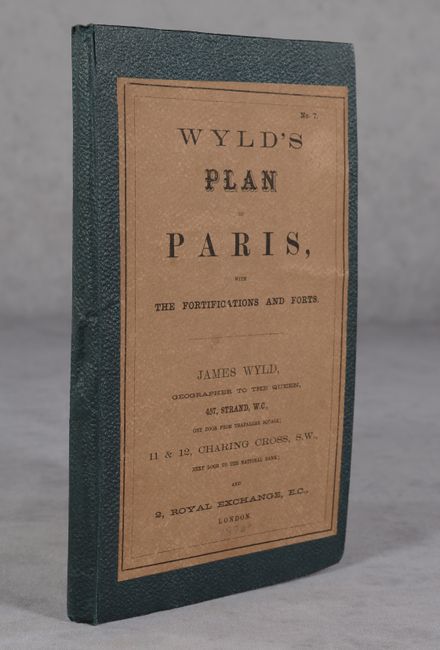
An attractive and highly detailed pocket map of the region surrounding Paris "showing the Enceinte and detached Forts, Communications, and horizontal Curves of the Ground" that was issued near the conclusion of the Franco-Prussian War. The fortified city of Paris is vibrantly hand-colored in pink along with over twenty small fortifications strategically surrounding the city. The map extends to include the city of St. Denis and smaller towns including Colombes, Ville d'Avray, Bagneux, St. Maur, Gagny and many more. Elevation, parks, forests, rivers, canals, and railroads are all well depicted. Folds into green cloth boards (5.0 x 8.3") with paper title label.
References:
Condition: A
Dissected and backed on linen with a hint of pleasant toning and minor soiling in the margins. Covers have light wear and bumped corners.