Catalog Archive
Auction 191, Lot 526

"Totius Alsatiae Novissima Tabula, qua Simul Sundgovia, Brisigavia, Ortenavia, Maxima Pars Marchionatus Badensis...", Visscher, Nicolas

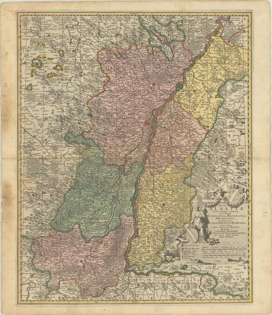
Subject: France & Germany, Rhine River

Period: 1700 (circa)

Publication:

Color: Hand Color

Size:
18.1 x 22.5 inches
46 x 57.2 cm
Download High Resolution Image
(or just click on image to launch the Zoom viewer)

This elegantly engraved map centers on Strasburg and spans the Rhine River from Germersheim in the north (just south of Speyer) to the German-Swiss border. The map is densely engraved with towns, rivers, mountains, and forests. A key in the title cartouche identifies cities (famous, small, and imperial), towns, villages, episcopal seats, castles, schools, and more. The allegorical title cartouche features two coats of arms (one of them for Alsace), putti, and a goddess, as well as two distance scales.

References:

Condition: B+

A sharp impression in contemporary color with light soiling, the majority of which is confined to the blank margins. Short edge tears in the left blank margin have been backed on verso with old paper.

Estimate: $160 - $190

Sold for: $130

Closed on 2/8/2023

Archived