Subject: Low Countries
Period: 1676 (published)
Publication: A Prospect of the Most Famous Parts of the World
Color: Hand Color
Size:
20.9 x 16.3 inches
53.1 x 41.4 cm
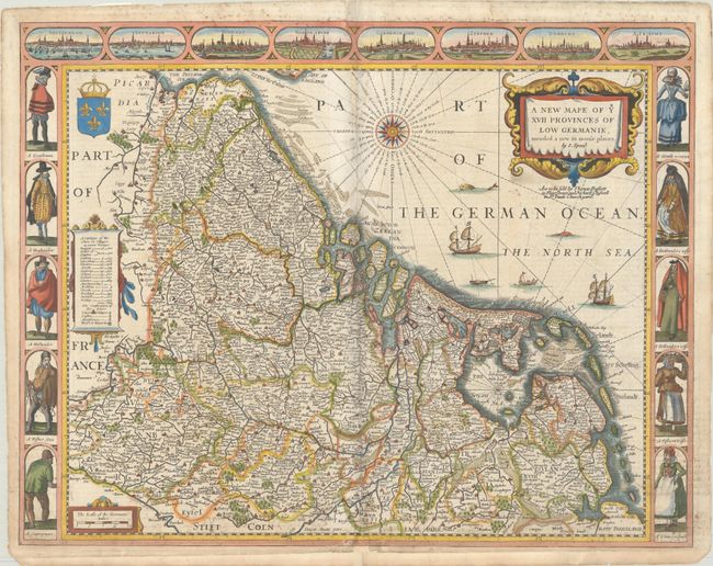
A stunning carte-a-figures map of the Low Countries. The vignettes of Amsterdam, Antwerp, Ghent, Middelburg, Groningen, Zutphen, Utrecht, and Atrecht fill the top border. The side panels illustrate the social hierarchy of society with superb illustrations of a gentleman, a "Brabander," a Hollander, a fisherman, and a countryman with their respective female partners. The map is filled with scores of place names, a table listing the number of cities and villages in each province, a lovely compass rose, and numerous ships in the North Sea. The English text on the verso has a description of the region, people and history. The imprint of Bassett and Chiswell appears below the title.
References: Shirley (BL Atlases) T.SPE-2f.
Condition: B+
A nice impression on a bright sheet with a couple of old manuscript ink notations in the map, and additional manuscript notations on verso that show-through a bit at the top and bottom of the sheet on recto. The map appears to have been separated along the centerfold with some loss adjacent to the compass rose at top and in the bottom border, and has been professionally repaired with a small amount of the image replaced in facsimile. Remnants of hinge tape on verso.