Catalog Archive
Auction 191, Lot 472
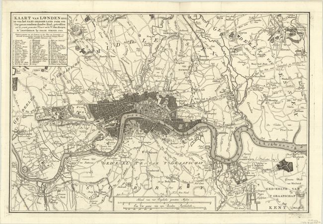
"Kaart van Londen Enz. en van het Naby Gelegen Land Ruim een uur Gaans Rondsom Dezelve Stad...", Tirion, Isaac

Subject: London, England
Period: 1754 (dated)
Publication: Hedendaagsche Historie of Tegenwoordige staat van Groot Brittannie
Color: Black & White
Size:
16.3 x 11 inches
41.4 x 27.9 cm
Download High Resolution Image
(or just click on image to launch the Zoom viewer)
(or just click on image to launch the Zoom viewer)

