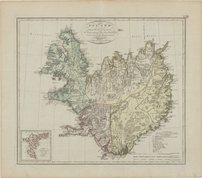
Subject: Iceland
Period: 1804 (dated)
Publication:
Color: Hand Color
Size:
21.4 x 18.7 inches
54.4 x 47.5 cm
This detailed map of Iceland expands on the French surveys of Verdun de la Crenne (1771-72) with place names and topography derived from the 1780 Eiriksson-Olavius map. Accompanied by a group of scientists, including Borda and the astronomer Pingre (credited in this map's title cartouche), Verdun de la Crenne traveled to the North Atlantic with instructions to explore various methods of measuring longitude along the route and correct inaccuracies on contemporary charts. The expedition arrived at the Westfjords and gathered data for three weeks. As a result of their limited survey, they shifted the country three and a half degrees to the east, but they did not adjust the longitude of the east coast. The resulting map, Carte Reduite des Mers du Nord... (1776) was actually less accurate than previous charts. Reinecke published a few maps drawing from the survey between 1800-1809; this is the largest and most detailed. The Faroe Islands are covered in an inset at bottom left. A key at bottom right translates Icelandic terms into German and identifies episcopal seats, cities, mineral fountains, hot springs, mountain trails, lava routes, and more.
References:
Condition: A
A crisp impression with a printer's crease at bottom.