NO RESERVE
"West Indies", Anon.
Subject: Gulf of Mexico & Caribbean
Period: 1796 (circa)
Publication:
Color: Black & White
Size:
12.5 x 7.4 inches
31.8 x 18.8 cm
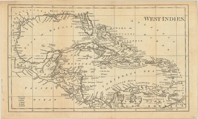
This anonymous map covers the entire Caribbean Basin along with portions of the southern United States and northern South America. Florida has a spurious mountain range running to Lake George and is politically divided between East & West. There is excellent coastal detail with numerous places names, ports, bays, shoals, and tiny islands. A key at bottom identifies the colonial possessions of the English, French, Spanish, Dutch and Danish.
References:
Condition: B
Issued folding with light toning and faint offsetting.