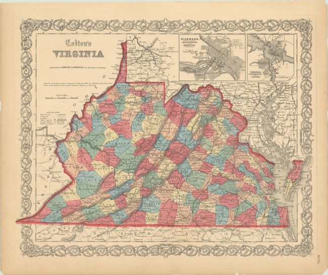
Subject: Virginia
Period: 1855 (dated)
Publication:
Color: Hand Color
Size:
16.1 x 13 inches
40.9 x 33 cm
An attractive map of pre-Civil War Virginia, before the separation of West Virginia in 1863. West Virginia is one of only two states formed during the Civil War; the other is Nevada. The map provides fine detail of towns, roads, canals, railways and much topographical information. At upper right are two inset maps: Richmond Henrico County, Manchester and Spring Hill; and Norfolk, Portsmouth and Gosport. All surrounded by Colton's decorative scroll border and published by Johnson & Browning circa 1860.
References:
Condition: A
Vivid color with a few minor edge tears confined to the blank margins that have been closed on verso with archival tape.