Subject: Eastern Texas, Oil
Period: 1918 (circa)
Publication:
Color: Black & White
Size:
24.1 x 20.3 inches
61.2 x 51.6 cm
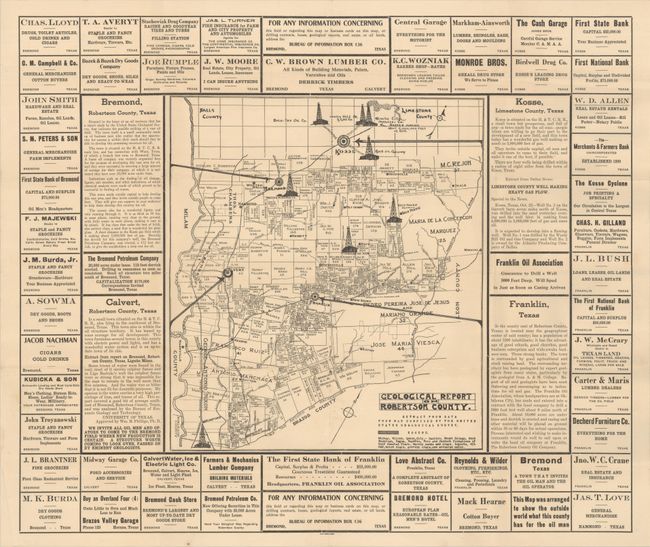
This promotional map for Robertson County was issued during the Texas oil boom by the "Bureau of Information" in Bremond, Texas. It shows the county subdivided by owner with several oil derricks prominently drawn on the map. Text at bottom right notes that "This Map was arranged to show the outside world what this county has for the oil man." Numerous local advertisements surround the map including ads for hotels, banks, and goods along with brief overviews for the cities of Bremond, Calvert, Kosse, and Franklin and their potential mineral and oil wealth. Calvert takes their messaging a step further, inviting "all oil men and operators to come to the Bremond Field where new production is certain." Blank verso. We found no past sales records or institutional examples on OCLC.
References:
Condition: A
Issued folding on a clean sheet of watermarked paper with a few small fold separations.