Subject: Texas
Period: 1837 (dated)
Publication:
Color: Hand Color
Size:
15 x 12.4 inches
38.1 x 31.5 cm
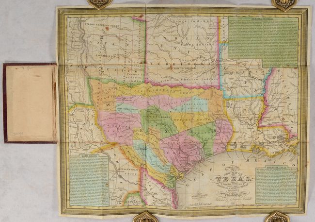
The Republic of Texas was a sovereign state in North America from 1836 to 1845. It was formed as a break-away republic from Mexico by the Texas Revolution. The nation claimed a large region that included all of the present state of Texas together with part of the former Mexican region of New Mexico (parts of present-day New Mexico, Oklahoma, Kansas, Colorado, and Wyoming). The eastern boundary with the United States was defined by the Adams-Onís Treaty between the United States and Spain, in 1819. Its southern and western-most boundary with Mexico was under dispute throughout the existence of the republic, with Texas claiming that the boundary was the Rio Grande, and Mexico claiming the Nueces River as the boundary.
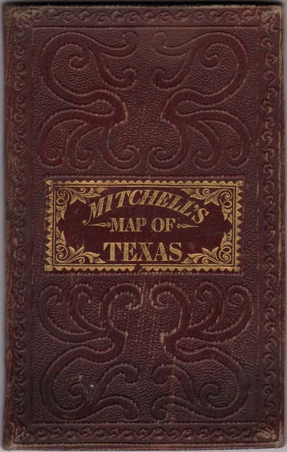
This important pocket map is one of the earliest to depict the new Republic of Texas. This is the third edition of Mitchell's influential map (first issued in 1835), and is based upon David Burr's map of 1833. According to Streeter, this edition is identical to the 1835 issue with the same title, copyright notice, scale, insets, and map case. Cartographically, the map presents Texas in its smaller Republic configuration with the southern border following the course of the Nueces River and the boundaries with the United States following the Red and Sabine rivers. Texas' interests are shown well beyond these boundaries, however, with additional grants located in the disputed region between the Nueces and Rio Grande (Beale & Grant's Grant) and in the panhandle region (Padilla & Chambers Grant, Dominguez Grant, and Wilson & Exeter's Grant). Almost the entire Republic is subdivided into land grants including Austin's Colony, DeWitt, Zavalla, Beale, Stephen F. Austin, Burnet, and more. Settlement, however, is mostly confined to south of a line from Nacogdoches to San Antonio with place names including San Felipe de Austin, Washington (on the Brazos), Brazoria, Columbia, Liberty and many more. Land grants to the north and west of this line had little to no development or defenses and were effectively controlled by the Comanche Indians. These frontier lands are described to contain "Droves of Wild Cattle & Horses", "Large Herds of Buffalo", and "Elevated Prairies." Three panels of text along the borders including Remarks on Texas, Land Grants, and Rivers of Texas were intended to encourage Anglo settlement in the region. One passage confidently describes Texas land: "A soil of great fertility and a geographical position highly favorable to commercial intercourse with the United States, and the rest of the World, are advantages which doubtless will at no distant period, render it an opulent and powerful State." Engraved by James Young. Issued on thin banknote-style paper and folds into brown cloth boards (3.0 x 4.8") with gilt title on the front cover.
References: Holcomb (TX) pp. 156-57; Raines p. 250; Streeter #1178B; TCU (TX) Plt. 18; TX GLO pp. 140-41; cf. Phillips (Maps) p. 841 (1835) & p. 844 (1843).
Condition: B
Issued folding with minor foxing, light offsetting, and a couple of short splits at the fold junctions (no loss). Covers have light wear.