Subject: Montana
Period: 1879 (dated)
Publication:
Color: Hand Color
Size:
14.3 x 10.6 inches
36.3 x 26.9 cm
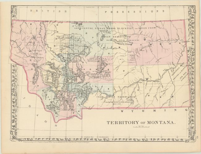
An attractive map published 10 years prior to statehood that shows limited surveying/development in the western portion of the territory. The majority of the region is dominated by Indian Reservations including the Flathead, Crow, Blackfeet, and more. The map shows the progress of the Northern Pacific Railroad with forty mile limits to its north and south. Locates numerous forts, a military reservation along the Montana/Dakota border, and notes several Indian treaties. Drainage and topography is well developed. The verso contains the western half of a double-page map of Kansas and Nebraska.
References:
Condition: A
There are a few minor spots and a very faint dampstain confined to the left side margin.