Subject: Oahu, Hawaii
Period: 1910 (dated)
Publication:
Color: Black & White
Size:
37.8 x 23.6 inches
96 x 59.9 cm
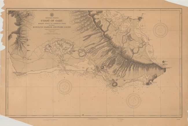
A highly detailed chart presenting the southern coastline of Oahu including Pearl Harbor and Wai'alae Bay. The waters are filled with navigational information including depth soundings, anchorages, bottom types, and notations. Inland detail includes the street grid pattern of Honolulu, Pearl City, and Kapahulu, and excellent depictions of the rugged topography and drainage systems. Space is reserved in the lower left margin for "Small corrections which can be entered on previous editions by hand from Notices to Mariners" and from other sources, with some corrections having been added. Dated 1904 in the plate with a 1910 Hydrographic Office stamp in the bottom margin. Drawn by A.A. Aguirre under the direction of Lieutenant Commander H.M. Hodges.
References:
Condition: B
On a lightly toned sheet with some minor staining and a few repaired edge tears at bottom that just enter the border. There are a number of edge chips that are mostly confined to the blank margins with the exception at bottom left with a tiny amount of border loss. There are minor ink and pencil manuscript notations.