Subject: Florida
Period: 1832 (circa)
Publication: A New General Atlas...
Color: Hand Color
Size:
8.2 x 10.1 inches
20.8 x 25.7 cm
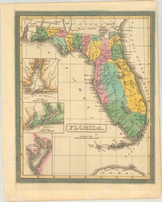
This scarce and handsome atlas map shows Florida more than a decade before its statehood. It delineates 15 counties and a vast Indian Reserve in the center of the state where the Seminoles live. County configuration is roughly current to 1831. Lake Okeechobee is Lagooma Mayaco. Roads are shown in the northern parts of the state, but they do not extend south of Tampa Bay. There are three insets at left showing Mobile Bay, the vicinity of Pensacola, and Tampa Bay. The map is surrounded by a keyboard-style border.
References:
Condition: B+
Full contemporary color with light foxing.