Subject: Washington, D.C., Alexandria
Period: 1905 (dated)
Publication:
Color: Black & White
Size:
22.6 x 39 inches
57.4 x 99.1 cm
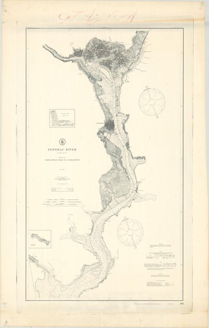
This detailed chart was issued by the Coast Survey in 1864 and updated here by the Coast & Geodetic Survey in 1905. This is the much scarcer version of the chart and was printed directly from the plate on thick paper (the earlier version was lithographed on thin paper). It covers the course of the Potomac River from Washington to the Occoquan Creek and is the most desirable sheet from the four-sheet Potomac River set. It presents the street-grid pattern of Alexandria, Georgetown and Washington, and locates the White House, Capitol Building, Smithsonian, and Washington Monument. The river is filled with numerous depth soundings, ground types, and buoys. A table at bottom right provides additional details concerning lighthouses in the area, tides, and more.
References:
Condition: A
A crisp impression on a bright sheet. There is some creasing and a manuscript notation all confined to the top and bottom blank margins.