Subject: Washington, D.C.
Period: 1901 (published)
Publication: H.R. Doc. 2, 57th Congress, 1st Session
Color: Printed Color
Size:
6 x 9.3 inches
15.2 x 23.6 cm
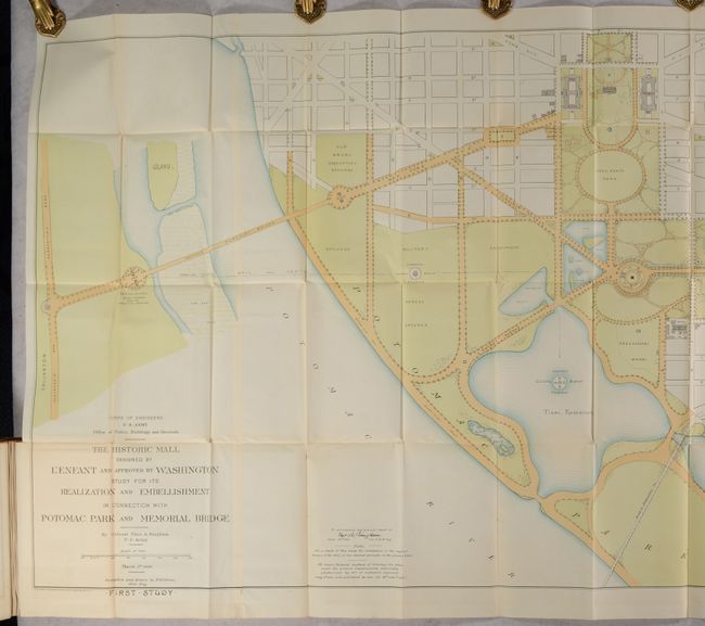
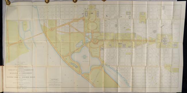
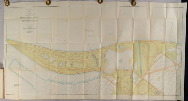
This 476-page congressional volume is noteworthy for its inclusion of the 72-page Appendix DDD or "Improvement and Care of Public Buildings and Grounds in the District of Columbia - Washington Monument." This section includes a set of maps drawn by Col. Theodore Bingham, who headed the Office of Public Buildings and Grounds (including the White House). Bingham was tasked with improving the area between the Washington Monument and the Tidal Basin, and these plans represent his proposals. The maps are filled with designs for gardens, nurseries, and scenic drives. In 1908, Congress allocated funds for a riverside drive from the basin inlet to 26th Street, and extended North B Street (the future Constitution Avenue) west as a park roadway to the Potomac. The five maps include:
A. The Historic Mall Designed by L'Enfant and Approved by Washington Study for its Realization and Embellishment in Connection with Potomac Park and Memorial Bridge (First Study), 1900, printed color (59.8 x 28.4").
B. The Historic Mall Designed by L'Enfant and Approved by Washington Study for its Realization and Embellishment in Connection with Potomac Park and Memorial Bridge (Second Study), 1900, printed color (59.5 x 27.7").
C. The Mall as Proposed by Pierre L'Enfant 1790 (from the Original), 1900, printed color (37.7 x 24.4").
D. Study for the Embellishment and Use of Potomac Park, 1900, printed color (53.8 x 26.8").
E. Proposed Development of Propagating Gardens Green-Houses & Nursery, 1901, black & white (27.5 x 40.1").
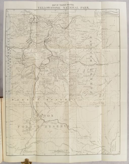
The volume includes numerous other plates and maps including the Map of Tourist Routes, Yellowstone National Park (16.0 x 20.7"). Hardbound in full contemporary leather with gilt title labels on spine.
References:
Condition: B+
The folding maps are very good with some light toning, minor color offsetting, a few spots of foxing, and several short splits at the fold junctions. Other maps and plates are very good to mostly near fine. Text is clean with a hint of pleasant light toning. Front board is detached and rear board is loose. Covers are scuffed and worn.