Subject: California
Period: 1877 (published)
Publication:
Color: Printed Color
Size:
22.4 x 25.6 inches
56.9 x 65 cm
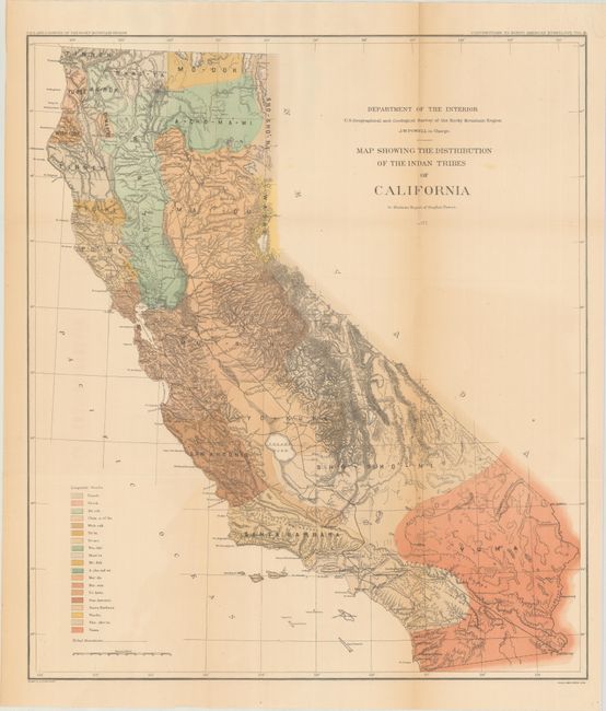
This large, colorful and historically important map was featured in Steven Powers' report and issued as Volume III - Contributions to North American Ethnology. Powers spent a decade collecting data for this report and is considered California's first ethnologist. The map is a detailed examination of the Indian tribes throughout the state with a color-coded legend identifying the nineteen Linguistic Stocks. There is good detail of the existing railroads between Ft. Yuma and the Los Angeles area, and up the central valley to Sacramento and north to end at Shasta. Drawn by H. Lindenkohl and lithographed by the venerable firm of Julius Bien. The loose map is accompanied by the full 635-page report with numerous in-text illustrations. Quarto, hardbound in red quarter leather with tips over pebbled cloth boards with gilt title on the spine.
References:
Condition: B
The folding map has light toning along the folds and some minor color offsetting. A 7" fold separation at top right has been closed on verso with archival tape. Text has uniform light toning. Covers are soiled, scuffed and worn.