Catalog Archive
Auction 191, Lot 230

"That Part of Disturnell's Treaty Map in the Vicinity of the Rio Grande and Southern Boundary of New Mexico as Referred to ny U.S. Surveyor...", U.S. Government

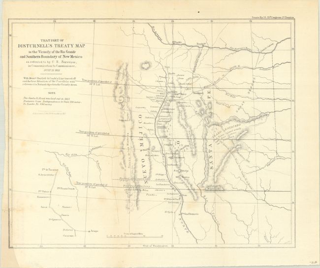
Subject: Southwestern United States

Period: 1851 (dated)

Publication: Sen. Ex. Doc. 55, 33rd Congress, 2nd Session

Color: Black & White

Size:
11 x 8.8 inches
27.9 x 22.4 cm
Download High Resolution Image
(or just click on image to launch the Zoom viewer)

This is a fascinating map centered roughly on Santa Fe. The map covers the area from the Arkansas River south to the 31st parallel and locates Albuquerque and Tucson. The parallels were being corrected from an incorrect position previously mapped, and this map illustrates both old and new parallels. Shows topography, hydrology, Gen. Kearny's route, the route of the Santa Fe Expedition, and the old Spanish military road among other interesting items. It was one of the key maps in the Bartlett correspondence regarding the dispute over the survey of the Mexican border.

References: Koepp, CIS 626, map #4; Wheat (TMW) #720.

Condition: B

Issued folding with faint scattered foxing. There is a binding trim at lower left that was cut to inside the border and has been replaced in facsimile (from another map).

Estimate: $110 - $140

Sold for: $130

Closed on 2/8/2023

Archived