Subject: Western United States
Period: 1851 (dated)
Publication: Atlante Geografico
Color: Hand Color
Size:
23.3 x 17 inches
59.2 x 43.2 cm
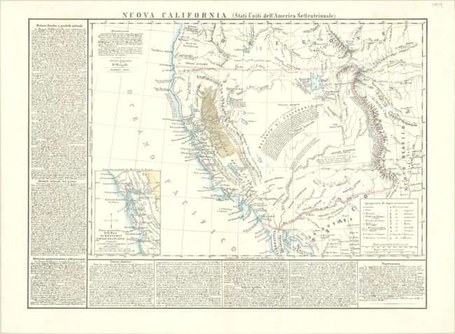
This scarce lithograph of the western US extends to Santa Fe in the east and to the French Canadian Colony on the Willamette River in the north. Although based on Hypolite Ferry's map of 1850 (who is credited in the Advertisement at top), Marzolla has added extensive notes on the history and resources of the region, as well as a legend identifying towns, anchorages, Indian settlements, missions, and the different types of minerals that are mined in the area. A substantial Gold Rush Region, Nva. Elvezia, is depicted in California. A large portion of the Southwest is labeled Deserto di California, with a note regarding Fremont's expedition in 1843-44. The wagon routes from Santa Fe and St. Louis to the west coast are shown, and an inset map depicts the San Francisco and Monterey Bay region.
References: Wheat (TMW) #714; Wheat (Gold) #191.
Condition: A
On a bright sheet with a few faint spots of foxing.