Subject: World & Continents
Period: 1609 (circa)
Publication: Epitome Theatri Orbis Terrarum
Color: Black & White
Size:
4.8 x 3.3 inches
12.2 x 8.4 cm
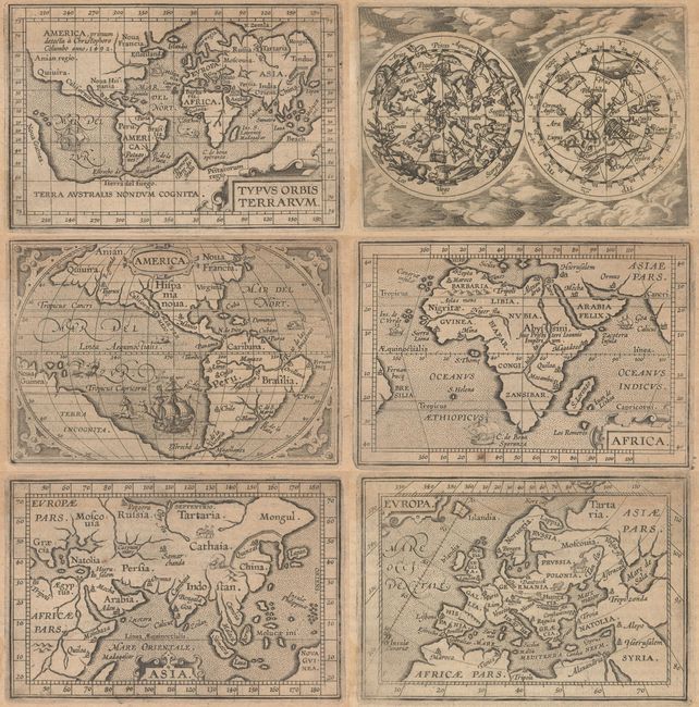
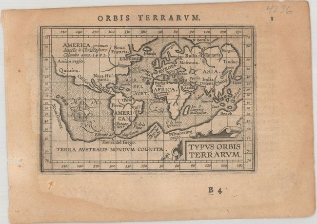
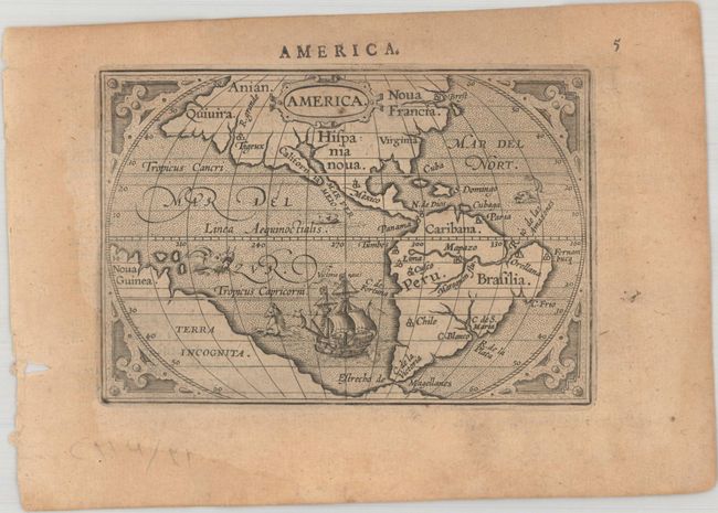
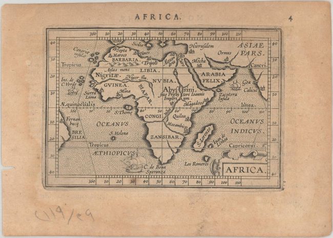
This matched set of maps featuring the world and continents was beautifully engraved by the brothers Ambrose and Ferdinand Arsenius, who had been assistants to Frans Hogenburg and co-engravers of Ortelius' folio Theatrum. This series of maps was accompanied by text by Michel Coignet and was published by Jan van Keerbergen. Latin text on verso. Sizes vary slightly.
A. Typus Orbis Terrarum. This is the first miniature world map presented on Mercator's projection. It depicts the large southern continent and is enclosed in a wide border marking the degrees of latitude and longitude. A notation in North America notes its discovery by Christopher Columbus in 1492. The stippled sea features two sailing ships and a sea monster. Reference: Shirley #230.
B. America. This map is lacking a great deal of detail but is interesting for a number of spurious rivers in North America, most notably two in Virginia, several feeding into the Gulf of California, and the R. Grande on the west coast near Quivera. The map is decorated with a large ship and several sea monsters and is surrounded in a strapwork border. Reference: Burden #143.
C. Africa. This handsome miniature map of Africa is lacking a great deal of detail but is interesting for its strange depiction of the Nile, which originates in a large lake south of the Equator. From this lake three large rivers flow to the seas: the Nile to the Mediterranean, the Congo to the Atlantic and what could be the Zambeze to the Indian Ocean. The map is decorated with a strapwork title cartouche and three sailing ships. Reference: Betz #47.
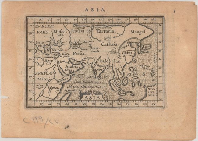
D. Asia. This charming little map includes depictions of the Great Wall of China, an exotic elephant, and camels in the interior of the continent. Korea is depicted as a long, thin peninsula, and Japan bears a rectangular shape.
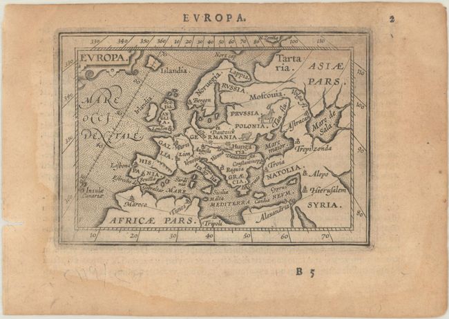
E. Europa. This miniature map of Europe is enclosed in a wide border marking the degrees of latitude and longitude and is beautifully engraved with stippled seas and tiny animals throughout the interior.
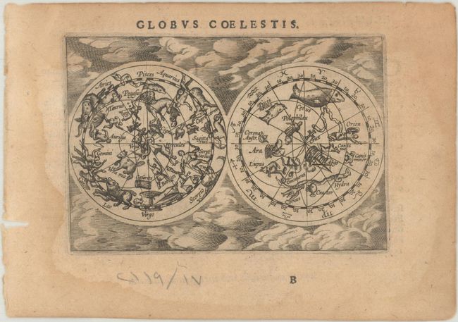
F. Globus Coelestis. This scarce miniature celestial map presents the northern and southern skies with mythological representations of the constellations based on Ptolemy set in a cloud background.
References: King (2nd ed.) pp. 86-87; Van der Krogt (Vol. III) #0001:333; 0010:333; 1000:333; 8000:333; 8600:333; 9000:333.
Condition: B+
Nice impressions on lightly toned sheets with marginal dampstaining that only enters slightly into the engraved images.