Subject: Southern United States
Period: 1900 (published)
Publication: Sen. Doc. 163, 56th Congress, 1st Session
Color: Printed Color
Size:
20.8 x 11.5 inches
52.8 x 29.2 cm
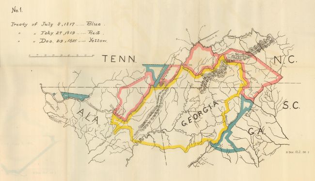
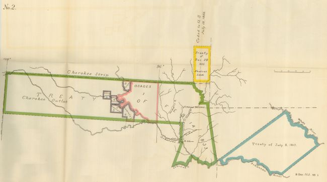
This lot includes two numbered, but untitled maps that were published in the report "Moneys Due the Cherokee Nation." No. 1 (20.0 x 12.0") consists of portions of North Carolina, Georgia, Alabama, and Tennessee. Colored boundaries and a key indicate the land involved in the treaties of 1817, 1819, and 1835. No. 2 (20.8 x 11.5") shows the Cherokee Strip and the Cherokee Outlet in Indian Territory. Colored boundaries indicate various treaties and possessions of other tribes. Although the original report concluded that the Cherokees were due an additional $1.1 million under the various treaties, the 1900 report denies the claim. The maps are still bound in the complete, 32-page disbound report and the subsequent 4-page decision transmitted by Judson Harmon, Attorney-General, this being the 56th Senate reprint of the identical report and maps from the 54th Senate edition.
References:
Condition: A
The maps have a hint of color offsetting, else fine. Disbound report is clean with a hint of toning, and is separated into two pieces.