Subject: World
Period: 1730 (circa)
Publication:
Color: Hand Color
Size:
23.3 x 17.5 inches
59.2 x 44.5 cm
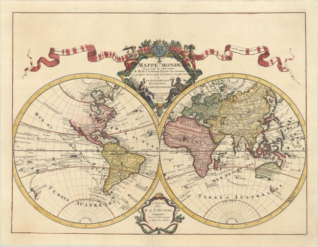
This is R. & J. Ottens' re-issue of this large, double-hemisphere map that illustrates Delisle's crisp, elegant style. The title cartouche is centered on the French royal coat of arms and allegorical female representations of the four continents. The map is up-to-date for the period with the most recent exploration routes noted, including those of Tasman and Dampier. In keeping with Delisle's desire for accuracy, the Pacific Northwest coast of North America is left blank above C. Mendocin, there is no evidence of Antarctica, and only a partial coastline of New Zealand is depicted. Delisle used accounts from French explorers and colonizers of the Gulf of Mexico region. He also had access to accounts from survivors of La Salle’s expedition in the late 1680's. Despite his efforts to produce highly accurate maps, this map still shows New Guinea connected to Australia. In addition, Terre de la Compagnie appears to the northeast of Japan with a partial outline continuing in the western hemisphere accompanied by a note regarding its discovery by Dom Jean de Gama. The tracks of major explorers and their discoveries are charted in the oceans.
References: cf. Shirley #603.
Condition: A+
A sharp impression on a bright sheet with minor creasing in the left blank margin.