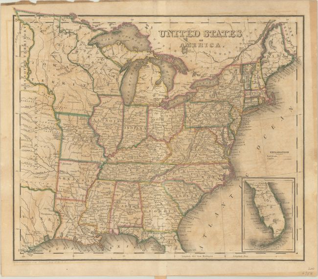
Subject: Eastern United States
Period: 1838 (circa)
Publication:
Color: Hand Color
Size:
10.6 x 9.2 inches
26.9 x 23.4 cm
This map of the eastern United States was drawn by John Drayton "from Tanner's map of the U.S." It extends from the eastern seaboard to a large Indian Territory and independent Republic of Texas with San Felipe de Austin as its capital. Above the state of Missouri is a sliver of Missouri Territory, an early depiction of Iowa Territory between the Missouri and Mississippi rivers, and Wisconsin Territory to its east. The southern part of Florida is shown in an inset on the same scale. Numerous Indian tribes and forts are located in the west, while several early railroads and canals are emerging in the east.
References:
Condition: B
There is light toning and offsetting.