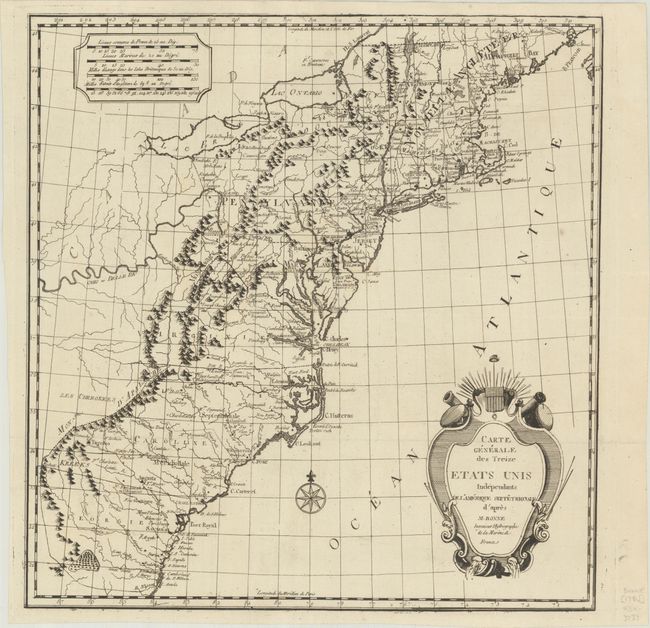
Subject: Eastern United States
Period: 1783 (published)
Publication: Le Voyageur Americain
Color: Black & White
Size:
15.4 x 16.1 inches
39.1 x 40.9 cm
The title of this map is an early reference to the United States, published in Alexander Cluny’s Le Voyageur Americain in 1783. This map was created by H. Klockhoff and first published in the 1782 edition of Cluny's book. The map depicts the 13 "independent" states with very early boundary lines extending west to the Appalachian Mountains. Only the Ohio River and the Cherokees are noted to the west of the mountain range. The map extends south to Nassau River, just north of present-day Jacksonville, Florida. Numerous cities and forts are labeled throughout the states. This appears to be the second state, with the engraver's imprint removed; later states can also be found dated 1784 and 1785 with several paragraphs of text added in the Atlantic.
References:
Condition: A+
A dark impression on a bright sheet, issued folding.